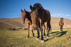
Kundudo wild horse horses are located in the Gursum district of
Eastern Hararghe Zone, Eastern Ethiopia on the top of Kundudo
(sometimes called 'W-Mountain' due to its appearance) location of
Kundudo.
This Mountain was bordered by two Woreda Gursum woreda and
Jarso Woreda and their capital town were Fugnan Bira and Ejersa Goro
respectively. From the Gursum Woreda (Madaro, Goba, and Harashi
Kebeles) are the nearest kebeles and Jarso Woreda (Badada, Chala,
Gidaya Lito kebeles) are the nearest kebeles. The altitude of this
mountain is 2900m.
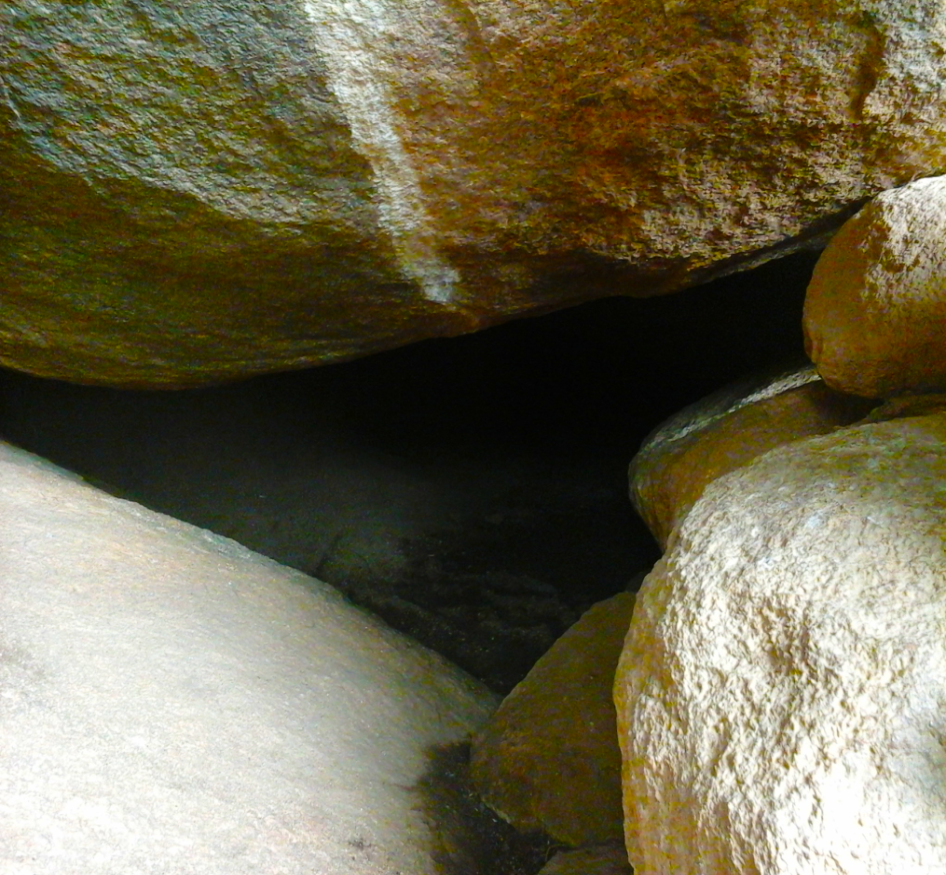
This cave is located in the East Hararghe Zone, in the
administrative district of Kombolcha, specifically in the
rural kebele called Jeirsa of Bakkei. It is situated 549 km
from Addis Ababa, 24 km from Harar, and 8 km from Kombolcha
(Raafuu town).
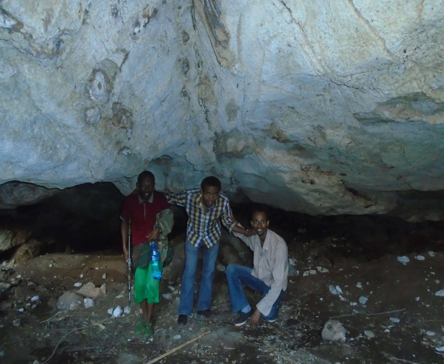
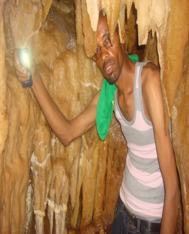
The front of the cave is very beautiful, but despite its appeal,
it is difficult to reach the cave itself. According to an expert
who entered the cave and verified it, he was able to explore only
320 meters before turning back without reaching the end.
The entrance to the cave is very challenging. After walking 33
meters inside, it becomes so narrow that a person cannot pass
through. Beyond that narrow part, however, the cave becomes
spacious and long, and there is even water inside.
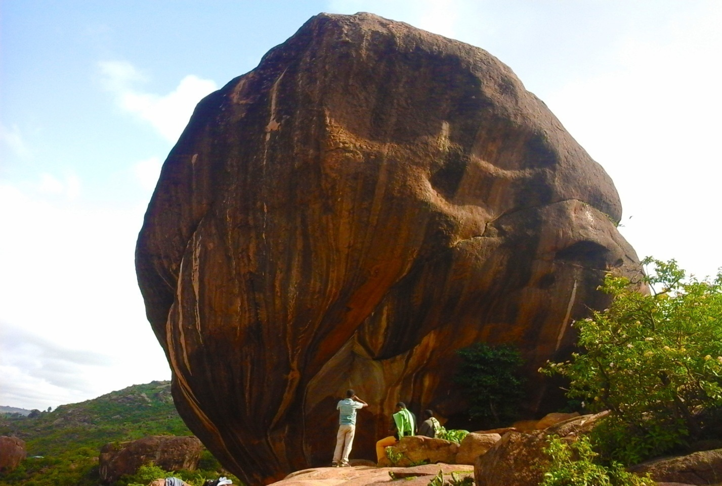
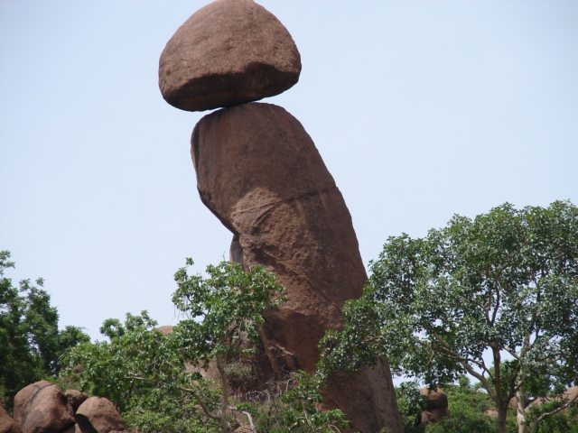
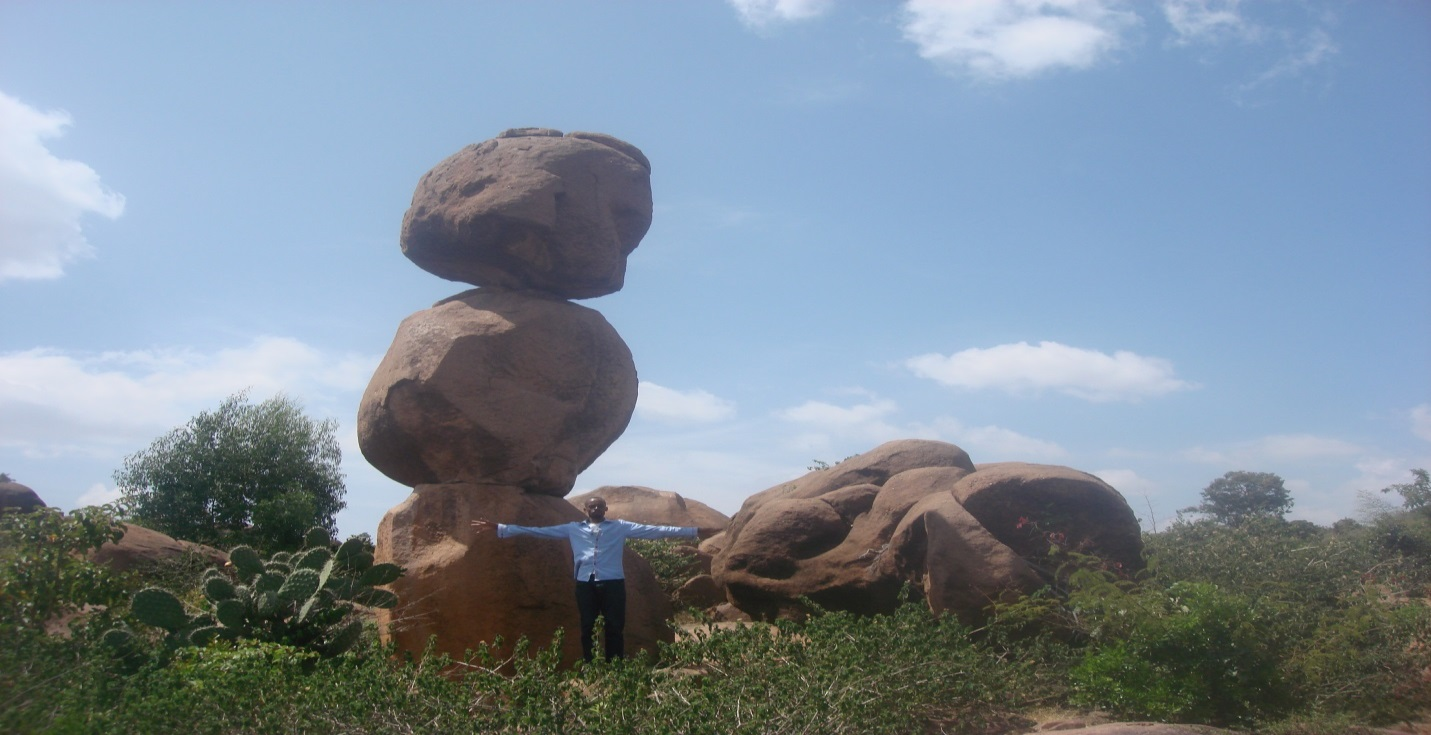
This rock is located in East Hararghe Zone, in the Babbilei District,
within the rural kebele of Sheek Abdii. Additionally, this rock is
found alongside the main asphalt road that connects Harar and Jijiga.
Due to its astonishing natural formation and its visibility from the
roadside, it has attracted the attention of many visitors.
When observed, the rock resembles the Kallacha (traditional symbol/staff)
of the Abbaa Gadaa (a traditional Oromo leader). In this way, the rock
is a long, naturally formed structure with another rock sitting on top
of it. The height of this main rock reaches 22 meters.
Moreover, the rock situated on top of it is 6 meters tall, and its width
at the top measures 24 meters. The contact point between the two rocks
is only 50 cm wide. To examine whether the upper rock could be separated,
the Italian colonial government once attempted to dislodge it using
military-grade equipment, but they failed.

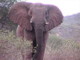
The Babbilei Elephant is found in the East Hararghe Zone,
Babbilei District, within the rural area of Erer Ibada.
The Babbilei Elephant belongs to the Loxodonta Africana species
(African elephant).
This elephant is unique compared to other
elephants. Among all elephants in the world, the Babbilei
Elephant is the largest. Moreover, the Babbilei Elephant has no hair
on its body.
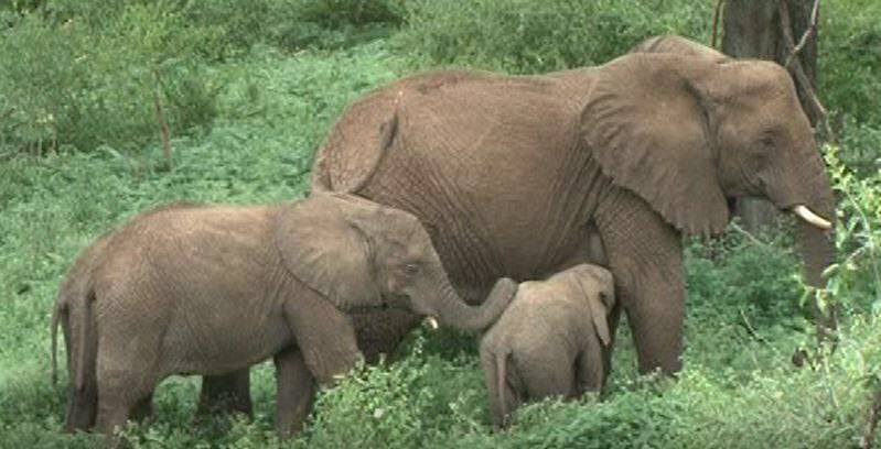
It does not cross territorial boundaries.
Elephants are social
animals that live and move in groups. The Babbilei Elephant
population is about 420. Their height reaches up to 4 meters,
and their weight ranges from 300 to 400 kilograms. In one hour,
they can run 60 to 70 kilometers to escape or fight off enemies.
Elephants are intelligent animals that think like humans. For instance,
if one elephant falls into a trap, others will work together to rescue
it. When one dies, they mourn and bury it together. Elephants inhabit
both forested highlands and semi-arid areas.
In Baabbilee, they are mostly found around Erer, Gobeille, Fadis,
and Mayyu Mulukkei.
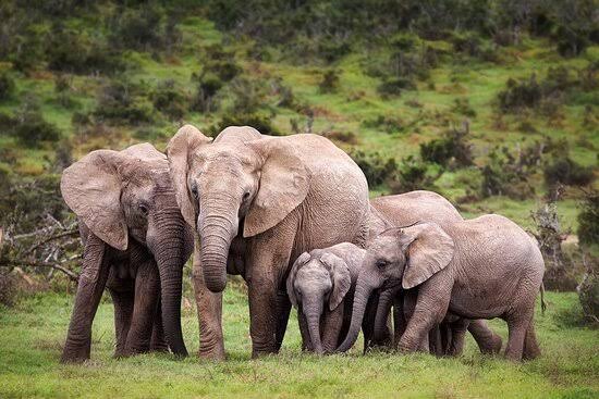
Elephants feed only on plants. For example, in a single day,
they can eat 3–4 quintals (300–400 kg) of food and drink over
200 liters of water.
Additionally, elephants can detect enemies from a distance using
their sense of smell, which is why they are called the “king of wild
animals.” In conclusion, the elephant is the king of the forest and
an animal that thinks like a human.
.jpg)
.jpg)
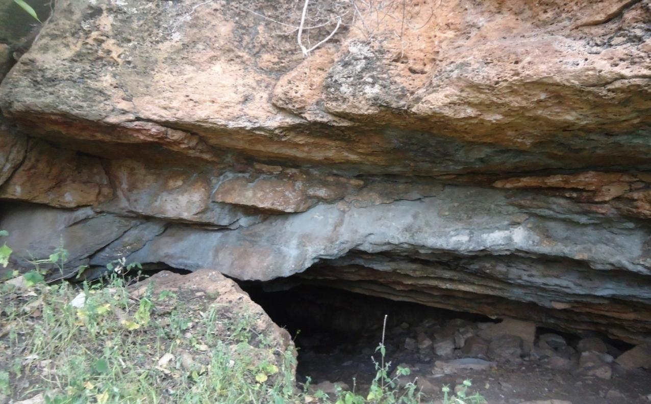
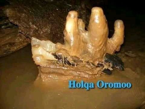
This cave is located in the East Hararghe Zone, Babbilei
District,
in the rural kebele of Gambeela. Buttuu Cave is a very large cave
situated in front of 'Tulluu Shiiree' hill in the Gambela kebele. It
is located 17 kilometers from the town of Baabbilee.
The cave is very old, and because it is located on a mountain
ridge,the surrounding climate and landscape make it pleasant
for visitors.
The name "Buttuu" comes from a local legend: long ago, a woman
named
Buttuu sat near the cave and would capture and eat people
traveling
alone—thus, it came to be known as Holqa Buttuu (Buttuu's Cave).
The cave has a large main entrance. Inside, it consists of
multiple
levels and spacious chambers. Additionally, it is said to be
connected
to Ali Kulloo Cave in the Harar area. According to elders, when fire
is lit inside Holqa Buttuu, the smoke is seen coming out of Ali Kulloo
Cave.
This method was used by the elders as a way to measure the distance
between the caves, which was otherwise difficult to determine.
Holqa Buttuu is a natural wonder. Its interior resembles a house, with
sections that look like different rooms.
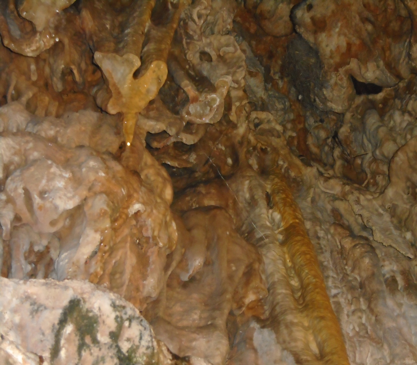
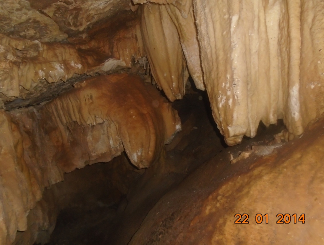
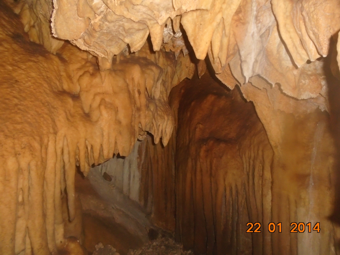
Among the large natural caves, Itu Cave is one of them. This cave is
located in the East Hararghe Zone, within the Babbilei District.
Specifically, it is found in the rural area of Abdi Buch, in a village
called Selama. It is approximately 15 kilometers away from the town.
The cave is naturally breathtaking and beautiful. The name of the cave,
"Ituu," comes from the Itu clan, a subgroup of the Oromo people.
The reason for this naming is rooted in history—during the time of the
Neftegna (invaders or colonizers), the Ituu people used this cave as a
place of refuge to escape from being massacred. Because they survived by
hiding in this cave, it came to be known as Holqa Ituu(Itu Cave).
The cave is located in a mountainous area with rocky and slightly flat
terrain. During the rainy season, water flows in front of the cave.
Inside, the cave is spacious and consists of multiple levels.
In conclusion, Itu Cave holds a long history and served as a shelter
that saved the lives of the Ituu Oromo people from enemies. Therefore,
it holds great historical and emotional significance for the Ituu
community and is deeply respected and cherished by them.
The structure of Aw-Bilal Cave is located in the East Hararghe Zone,
Babbile District, in the rural area of Nejeta Gemmachis, specifically
in the village called Erer Ameiro, situated in an upper area.
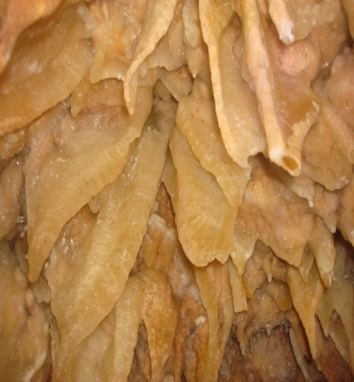
This cave formation is naturally stunning and fascinating. When observed
, the cave entrance appears narrow. However, once a person enters,
it gradually widens as they proceed. Inside the cave, it expands in such
a way that one can move around freely as if circling a room.
The name "Aw-Bilaal" comes from natural rock formations found around the
cave that resemble the figures of a man and a woman. Based on this,
religious elders gave the cave the name Aw-Bilal.This is what the
naming is based on. However, at present, the statue has been broken
and taken by the Italians. Nearby, there are also the formations
called Hallayya Kalidy and Hallayya Kannisa, which are located
within a distance of less than 1 km from this site.

Goro Mity Cave is located in East Hararge Zone, in Mayyu Mullukei Woreda,
within the Soddoma Kebele. It is found about 14 kilometers from the
woreda’s main town, Huusee.
This hill formation is naturally made, featuring a wide opening that is
large enough for a vehicle to pass through. The site is a two-hour walk
from Soddoma Kebele on foot.
It is situated on elevated land, offering visitors a pleasant climate. Geographically, it borders Gola Odaa Woreda.
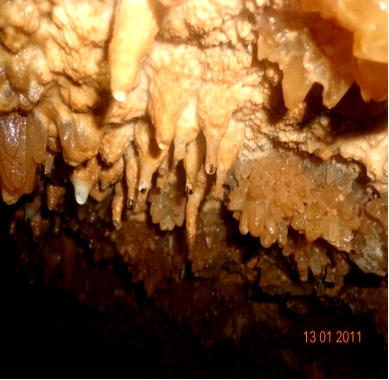
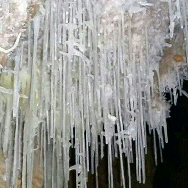
As you enter Goda, the entrance has a single main passage, but once inside,
it branches into three different directions:
1. First path – Western direction:
This area features flowing water channels and nocturnal
birds resting on the water surfaces.
These create a lively and enchanting scene.
2. Second path – Eastern direction:
The entrance to this section is narrow and requires crawling on
one’s knees to enter. The interior is quite dark, but when
illuminated, colorful mineral deposits appear, believed to have
healing properties. Some of the formations inside are broken,
and the rooms resemble naturally formed houses.
This section contains eight chambers.
3. Third path – Northern direction:
This area is visually striking. Inside,
there are mineral formations shaped like human fingers,
some of which sparkle when light is shined on them.
There are formations resembling hanging teeth and nocturnal
birds that rest atop the minerals.
This area contains three visible chambers.
According to local informants, young men and women used to gather
and play inside this cave in earlier times.

Goda Urruubsuu is a naturally formed cave located in East Hararge,
in Mayyu Mulluqqee Woreda, within the Ciirraa Kebele, in the village
of Aanannoo. It is about 9 kilometers from the Woreda’s main town,
Huusee.
The cave is situated atop a hill, west of Ciirraa. The entrance to
the cave is quite narrow and requires one to crawl to enter. Once
inside, the passage slopes upward, and the cave interior becomes
more spacious and visually appealing. A special feature of the cave is the presence of drinking water used
by people to refresh themselves after spiritual immersions, making it
unique.
The formation of this cave runs from the eastern slope of a steep
mountain to the western side. According to local accounts, in the past, people in the area would narrow the stone paths to preserve the structure
The cave is divided into four main sections.
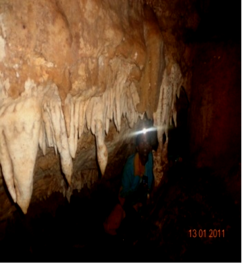
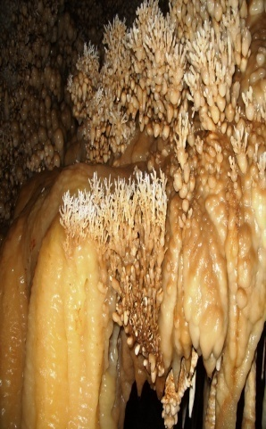
1. First Section – The Immersion Area:
A wide space featuring hanging stalactites shaped like human
figures and fingers, where people traditionally immerse
themselves.
2. Second Section – The Pause Area:
Located further inside, it is a resting point where one
encounters beautifully colored minerals and formations.
3. Third Section – The Bird's Nest Zone:
This area resembles a lightly structured house and is home to
nocturnal birds that rest on the mineral surfaces.
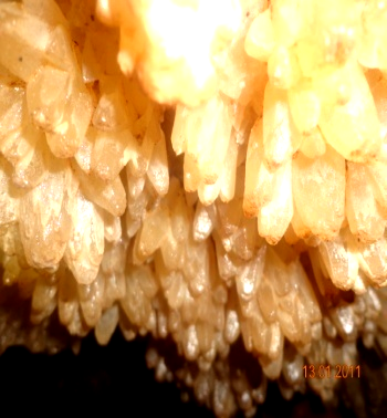
4. Fourth and Final Section – The Crystallized Zone:
This section features smooth, shiny, tightly layered mineral
deposits with no visible air passage. The minerals overlap
beautifully and glisten.
In general, the cave is explored on foot. Between each section, the passages are connected by narrow mineral-lined corridors. These mineral walls, with their naturally colorful patterns, are pleasing to the eye and used decoratively. The stones here grow upward and downward in crystal formations, with their hollow cores collecting moisture, which then slowly drips down.
These caves are located in East Hararghe Zone, Baddannoo District,
in the village of Tortora Guddaa. They include the Diimaa Cave,
Waadendeyo Cave, and Ziqeeyaa Cave.
The natural formations inside
these caves are astonishing. Especially, the Waadendeyo Cave has a small
entrance, but once inside, you can move around freely as you wish.
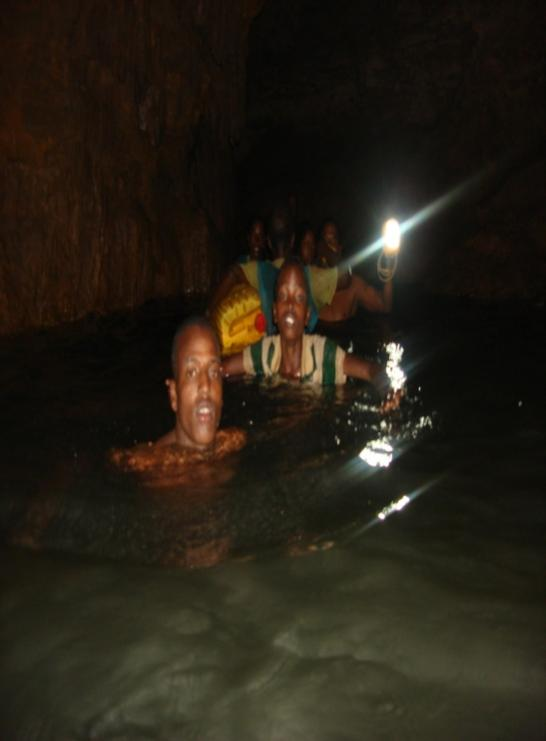
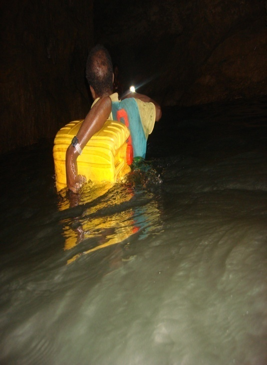
This water is found in the East Hararghe Zone, Gurawaa District,
in the village of Rakko Barsaalaa. It is a very large body of water,
and the cave where this water is located is also vast and has an
astonishing natural formation. Because of its impressive size and unique
features, it is very popular.
Moreover, the local community highly values
this water source, as there are no other nearby sources of water.
They rely on it, often carrying it back in containers. It is located 75
km
from the city of the zone and 30 km from the district town
The cave is found near the Malka Goraa Village area, at the base of the
Gare Ol’ady hill. It is on the first level and spans a width of 60
meters, with a depth of up to 300 meters.
The formations inside the cave
are impressive, and it has attracted spelunkers (cave explorers).
The cave is located 11.5 km from the district town, 35.5 km from the city
of the zone, and 560.5 km from Addis Ababa.
The entrance to the cave is
narrow, but it expands quickly, allowing visitors to move freely inside
and explore as desired.
The Dire Haro Cave is a natural cave located in the East Hararghe Zone,
Kurfa Challe District, in the village of tikka kebele.
It is situated 5 km
from the district's main town. The cave is found at the base of Gare
Mullate east direction and lies slightly below its summit.
The cave's natural formation is created by the mountain range extending
from the western to the eastern side of Gare Mullate.
Historically, the cave was much larger, but the local community has
reportedly reduced its size by closing off some parts. Inside the cave,
it is divided into several sections, and it is possible to move
from one to another by foot.
During rainy seasons, certain passages become muddy, making it difficult
to navigate. Some sections of the cave contain stones with natural
colors that attract visitors. These stones are used in various ways,
and the cave’s walls are covered with plant life, creating a beautiful
sight.
Some parts of the cave even feature small birds nesting inside.
The cave has been explored by local spelunkers and is known to extend up
to 102 meters in length, as reported by the researchers.
This cave is considered an important site for tourism development.
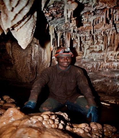
The Oromo Cave is a natural cave located in the East Hararghe Zone, Gursum
District, in the village of Biyyo Negeya. It is situated 13 km from the
district's main town.
The second largest town in the district, Fugnan hujuba,
is located just 1 km away from the cave, and the cave is accessible via
the
road leading from Gursum to Jarso, and then further to the village of
Ejersa Goro, located near the Mogg’a river.
The cave is located at the base of Gare kundudo, on the wester
n side of
the mountain, just below its summit. The cave was naturally formed along the
eastern to western side of Gare Kundudo.
Historically, the cave was much larger, but the local community has
reportedly reduced its size by closing off some parts. Inside the cave,
it is divided into several sections, and it is possible to move from one to
another on foot. During rainy seasons, certain sections become muddy,
making it difficult to traverse.
Some parts of the cave contain stones with
natural colors that attract visitors. These stones are used for various
purposes, and the cave walls are covered with plants, providing a unique
sight. The cave also houses small creatures with eight legs or other forms
of wildlife.
The cave has been explored by spelunkers from France and Italy, and it
has been documented with photographs and shared on the internet.
It is considered the third most important cave in Ethiopia and the fifth
in Africa.

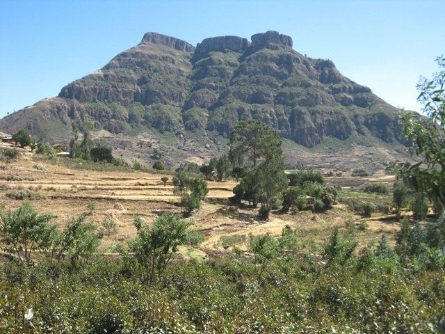
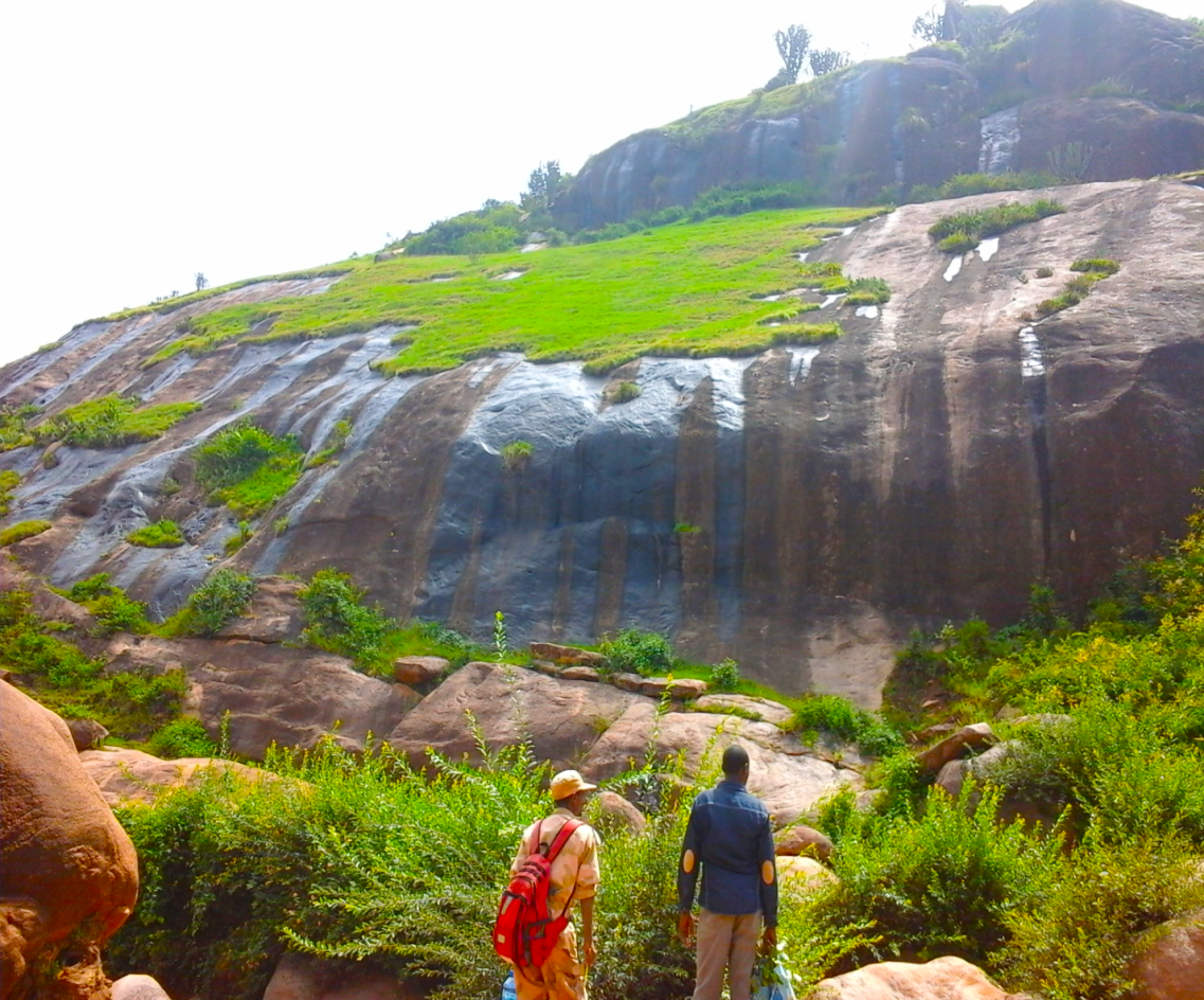
In our zone, there are two life refreshing mauntains that deserve
to be toured:Garemullate Mauntain and Kundudo or W-Mauntain.
1. Gare Mullate Mauntain
This mountain is located in the East Hararghe Zone, and it is bordered by
several districts: Kurfaa, Gurawa, Baddanoo, and Qarsa. The name "Gaara
Mullataa" has been given for two reasons, as explained by the elders.
The first reason is that a person named "Mullata" lived there for a long time, taking care of livestock at the summit. This information was shared by the elders. The second reason for the name is based on the mountain's great height and visibility. From afar, it is easily seen by people, so it became known as Mullataa. Its elevation is 3481 meters above sea level.
The mountain extends from east to west and is divided into two parts: the
eastern part is called 'Aws'idaa,' and the western part is known as 'Gaara
Ahmad.'
Gare Mulleta is not only notable for its size and height but also holds
historical significance. Some of the well-known historical sites located on
the mountain include Awusa'ida, Aminura, Barizala, and Irreasse.
Additionally, every year on October 17th, the local community and visitors
gather at the summit, performing various rituals, prayers, and cultural
songs.
As a natural formation, the mountain is situated at an elevation of 3841
meters above sea level, with a breadth of about 15-14 meters.
It has a flat plain, similar to a sports field, which stretches
out like a carpet. Visitors can easily walk across the field,
and when they stand still, they can hear the wind and sounds of nature.
The climate on the mountain is cool, with frequent winds that refresh and
entertain visitors. The area is rich in wildlife, including trees,
birds, and various animals like jackals, baboons, and other species.
The mountain can be accessed by a single path used by livestock, and four walking paths for humans. There are also two main roads: one from the nearby town of Jiruu (about 5-7 km) and another from the district of
Kurfa Chelle to Gurawa to 'Biibihoo' (about 7 km), with an additional 3 km of
natural paths leading to the summit.
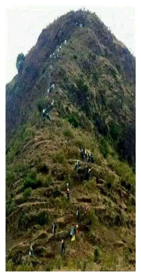
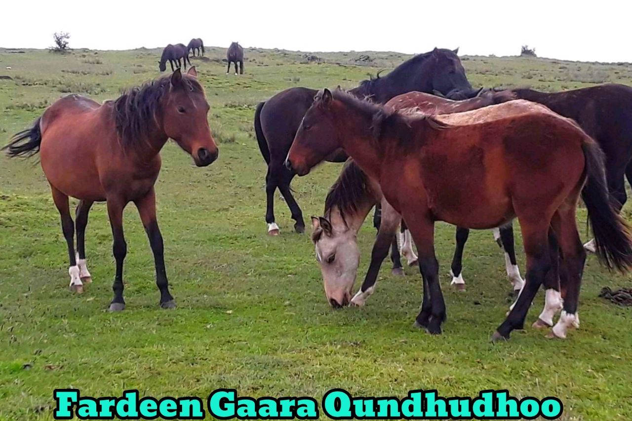
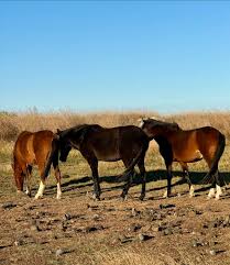
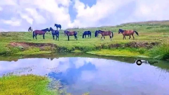
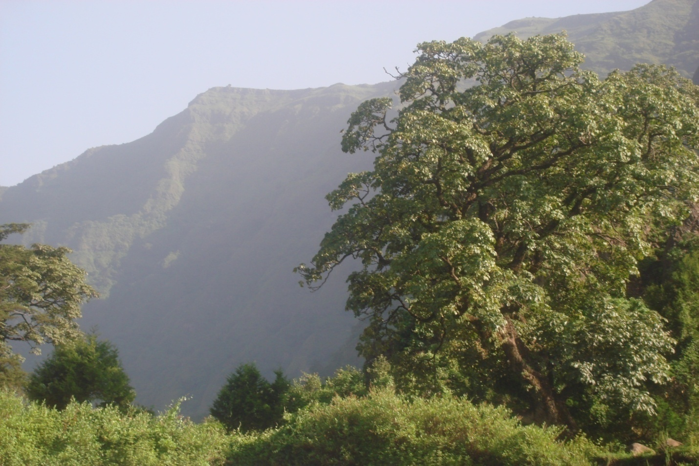
2. Kundudo Mauntain
Kundudoo Mauntain and Wild Horses on it are located in the East Hararghe
Zone, in the Gursum district, about 20 km from the main town.
This natural
formation has an elevation of 3959 meters above sea level, and its breadth
is approximately 10-8 meters per hectare, or about 8 hectares in total.
The area is flat and similar to a sports field, covering around 8 hectares.
When standing on the field, one can hear the sound of the wind.
The climate here is cool, and the area is known for frequent winds, making it a refreshing place for visitors. It is a suitable environment
for relaxation and enjoyment, with an abundance of natural beauty.
The forested area below the mountain is home to various species of birds
and animals, including jackals and other creatures.
The top of the mountain is also the site of a development project that
includes residential homes and a security post, providing a safe place for
inhabitants. The number of residents is increasing as more people move to
the area.
As for accessibility, the mountain can be accessed by a single livestock
path and two walking paths. There are also two main roads that lead to the
area: one from the town of Gursum, passing through Fu/Ujubaa, and another
from the town of Jaarsoo to Badhaadha. From there, it is about a 2 km walk
to reach the mountain summit.
Another route from Fu/Biraa to Saqaree takes
around 18 km, with a 2 km walk to the summit.The area is famous for its stunning views and the natural wildlife that
thrives there, making it an excellent spot for nature lovers and tourists.
Keteba Rock is a significant natural site located in East Hararghe Zone,
specifically in the Kombolchaa district, within the Saamtee kebele area,
near Atashu village and Saka (Bubbis). The site is located approximately
561 km from Finfinnee (Addis Ababa), 36 km from Magaalaa Guddoo in East Hararghe Zone,
and about 20 km from Malka Rafu of district town
and 6 km from Saamtee kebele adminstration.
The geological features of Keteba Rock are awe-inspiring. The large rock
formation stands 9 meters high, with various intricate carvings and images
stretched into its surface, making it a captivating site for visitors. These
carvings include human figures, cattle (saawwan), and symbols of the stars
(gumee), among other motifs.
The total number of carvings is estimated to
be around 23. These carvings, which are likely of great cultural and
historical significance, offer a glimpse into ancient life in the region.
Visitors can reach the site by a rural road, which is approximately
200 meters from the base of the rock formation, though the last stretch of
the journey is on foot.
There is concern that children might damage or destroy these
historical carvings, as some reports indicate that the figures may be at
risk.